What We Are Working On
- Direction Setting & Project Launch: Engage local trail and government leaders to discuss general environmental constraints and opportunities for trail connectivity.
- Research: Conduct a thorough site analysis of the study area to determine feasible route options.
- Landowner Outreach: Meet with landowners along the identified feasible trail route, gauge landowner sentiment, and adjust trail routes accordingly.
- Plan Development: Develop preferred trail alignment in tandem with local leaders. Develop renderings and schematics to visually support trail recommendations.
- Final Plan Preparation: Publish final plan for review by stakeholders, elected officials, and the public.
Current plans underway
History and Background
The Overmountain Victory National Historic Trail commemorates the 1780 march of over 2,000 horse-mounted patriots to the Revolutionary War battle at Kings Mountain. The troops marched south in pursuit of Major Patrick Ferguson’s loyalist army. After a total journey of approximately 272 miles through Virginia, Tennessee, and North Carolina, the Overmountain Men defeated the loyalists at the Battle of Kings Mountain in South Carolina. The patriot victory at Kings Mountain is recognized as a turning point in the war that eventually resulted in American Independence in 1781.
In 1977, North Carolina Congressman James T. Broyhill along with 13 co-sponsoring legislators, introduced a bill to designate the route as a National Historic Trail. Three years later, on September 8, 1980, President Jimmy Carter signed the bill (P.L. 96344) into law, confirming the designation.
In 2019, Governor Roy Cooper signed legislation authorizing the Overmountain Victory Trail segments located within North Carolina as a designated State Trail within the North Carolina State Parks system.
Master Planning Efforts
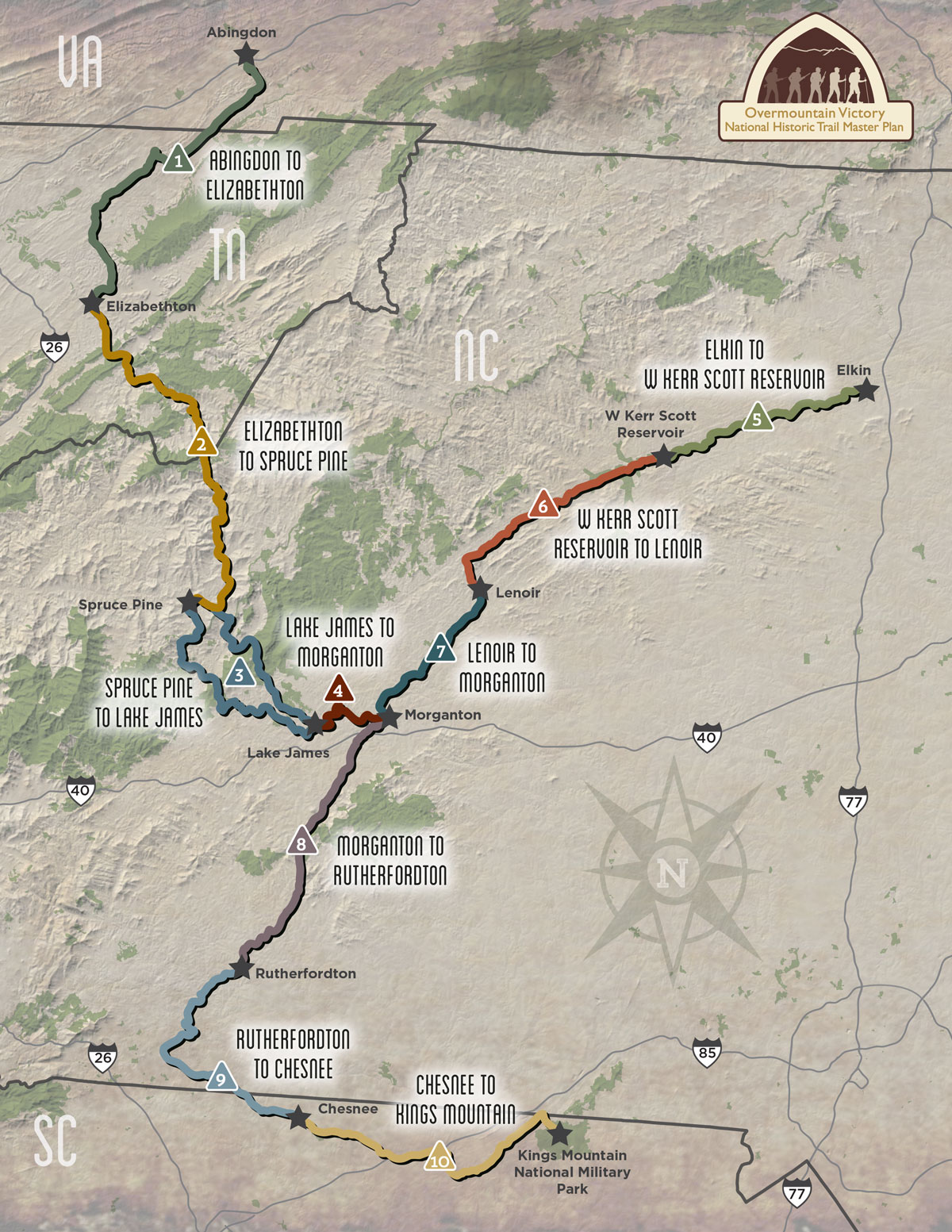
In 2014, the National Park Service (NPS) began a concentrated effort to develop regional trail master plans for the 330-mile historic route of the Overmountain Victory National Historic Trail (OVNHT). These plans were typically funded through a cost-share program between the NPS, local governments, and non-profit trail organizations. The purpose of these planning efforts was to strengthen multi-jurisdictional partnerships and engage landowners to expand and connect the growing network of certified OVNHT segments throughout Virginia, Tennessee, and North and South Carolina.
The trail corridor is divided into the following ten (10) planning areas: 1) Abingdon to Elizabethton; 2) Elizabethton to Spruce Pine; 3) Spruce Pine to Lake James; 4) Lake James to Morganton; 5) Elkin to W. Kerr Scott Reservoir; 6) W. Kerr Scott Reservoir to Lenoir; 7) Lenoir to Morganton; 8) Morganton to Rutherfordton; 9) Rutherfordton to Chesnee; and 10) Chesnee to Kings Mountain.